The ‘Tasman River Trail’ is a small easy to ride, 20km return section on the ‘Alps to Ocean Trail’. It is situated on the opposite side of the Tasman River with breathtaking views of Aoraki (Mt Cook).
If you are driving to this trail you can head along towards the mountains along Braemar Mt Cook Station Road. The road is gravel but well looked after due to the forestry and farming in the area. Be on the lookout for other cars, trucks and cyclists, especially when coming up to the single lane bridges.
Follow the road all the way towards the mountains past the top of Lake Pukaki and into the braiding Tasman river. You will pass a small car-park for one of the walking tracks, but keep going and you eventually come over a single lane bridge. When you reach the entrance to Mt Cook Station (Private Property) you will see a small carpark on your left. Park up here as it is the start of the trail.
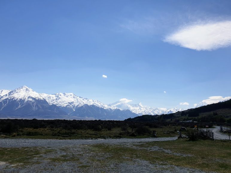
From the car-park you can follow the road towards the Tasman river where you will get good views towards the top of lake Pukaki. The trail then leaves the road and goes through a stock-gate. It is from here you start to follow the river upstream towards the alpine ranges. This trail took us some time as we were constantly stopping to take photographs. It was a beautiful dry 24’C day and no one else was on the trail so we felt privileged to be in such a beautiful natural area.
The rest of the trail is quite easy, at a few points we had to go over the dry river bed and a scree slip. During that point it was easier to walk the bikes as the rocks were quite slippery. Expect to get your feet wet when you travel over some small ankle deep streams. The trail opens up on some wide grassy areas that are used for farming, we occasionally had to manoeuvre through some livestock.
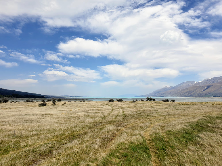
Looking towards the top of Lake Pukaki 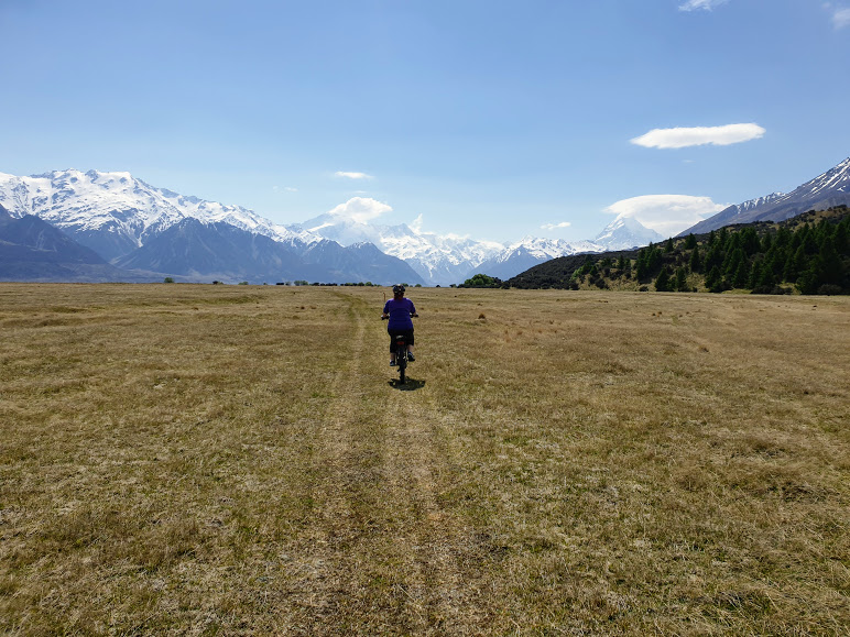
A grassy part of the trail towards Aoraki (Mt Cook)
Signage on the trail was pretty good, with the Alps to Ocean signage at most major junctions. It was easy enough to find our way up the river. Some parts of the trail needed a little maintenance but it was nothing our x-citiy e-bikes couldn’t handle. Although the trail appeared flat it did raise over time, however with the e-bikes this was hardly noticeable.
After about 10kms we came to a small picnic area next to a helicopter pad. This helicopter landing site is used for people who want to cycle the Mt Cook Village part of the Alps to Ocean and then be transported over the river from the airport. Although we didnt see a chopper land the day we went, I imagine in peak time you would need to move your lunch quickly from the table as it was about 10 meters from the landing Zone.
The views from this part of the trail are spectacular, it looked to me like you could go a lot further up the river, but on this occasion we were pressed for time and had to return. To get to the car-park it took us about 1hour 15mins from Tekepo, so make sure you leave early and give yourself plenty of time as we were disappointed we had to leave.

The Tasman River Trail is a 20km return trip along the bank of the Tasman River. The is easy but make sure you have good off road tyre as you will be going over grass, slightly boggy terrain and rocky outcrops. The e-bikes handled this trail exceptionally well using less than a quarter of the battery in a low assist. For further information on this trail visit the ‘Department of Conservation’ site.
